Oct. 14: Any Photos Coming from Hikianalia?

The software for downsizing photos for sending via the satellite phone on Hikianalia is malfunctioning.

The photos are large (500 kb+), so the transmission of the photos keeps dropping off in mid-transmission.

NOTE: PVS is  illustrating the blogs with photos and graphics from the PVS archives.

Continue Reading

Hikianalia Report: October 13, 7:40 PM HST, winds abating, steering east, a whale underwater, a big-eye tuna …

The strong winds of the last two days have gradually abated and backed to westerly with a northern component, excellent for us as we make our way east.

We caught a nice big-eye tuna (ʻahi) today and turned it into sashimi and fish curry.  Mahalo Kanaloa.

We are steering Hikina (east).  This direction and current conditions are very gentle on the canoe and crew.  If we can keep this up all night, we can pass 170 W latitude tomorrow.  Our eastward goal is about 160 degrees west, when we can probably turn north toward Tubuai and Tahiti.  We are staying south to take advantage of good winds and to avoid going north too soon where we might get becalmed near the center of a high pressure system (the Horse Latitudes around 30° S).

Prevailing Winds: Hikianalia is at 34° S, in the Westerlies. The Horse Latitudes are an area of variable winds mixed with calm lying to the north, around 30° S). North of the Horse Latitudes are the SE Trade Winds that Hikianalia plans to ride to Tahiti.

Today, we were steering by the wind direction and the swells.  The wind tends to change so the helmsman must be aware of those shifts.  At the start of the day, we wanted the wind on our port  beam (the left side of the canoe).  In the afternoon after a rain squall passed us, the wind shifted more west and we need to keep the wind more on the port quarter (the back corner of the canoe). We also use the direction of the swells, which are more constant.  Today’s swells are northwest so we keep them hitting the aft port manu.  We can also use shadows on the deck to keep us steering straight, such as lining up the shadow of a shroud on the corner of a deck box.

Sail Data

  • time: 2012-10-14 05:40 UTC/GMT (19:40 HST Oct 13)
  • position: 34 degrees 11.4 minutes S 172 degrees 32.5 minutes W
  • course: 090 degrees True
  • speed: 6 to 7  knots
  • weather: mostly cloudy, some clear patches
  • wind: just north of west, 12 to 18 knots
  • sea state: NW swells  6 to 8 feet, N  swells 3 to 4 feet, wind chop W 2 to 4 feet
  • vessel and crew condition:  all ok (Faafaite also)

Education Data:

  • Celestial Observations, Navigation Stars, Planets and Moon Phases: sun only
  • Animal Life: Bruce saw a large whale pass underwater near the hoe. It didn’t surface so we don’t know the species.  We caught a nice big eye tuna today and turned it into sashimi and fish curry.  Mahalo Kanaloa.
  • Sea Birds and Sea Life: We saw an albatross and a petrel.
  • Marine Debris: None seen today.

Resources

Continue Reading

Oct. 13, 2012: Why is Hikianalia Heading Toward Rapa Iti Rather than Tahiti?

Predicted winds indicate heading 075 degrees true (La/Aina Koolau) toward Rapa Iti as the first waypoint was the best option to cover the long distance we need to travel, given the location of our destination of Tahiti and the direction of the prevailing winds along the sailing route.. (For the location of Tahiti, Rapa Iti, and Tubuai, mentioned below, see the Google Map.)

La/Aina Koolau are the direction just about Hikina, or East. Click on the image for a larger compass.

What we must avoid is getting too far north while still west of Tahiti, then find easterly winds in our faces. That would make it difficult to reach Tahiti because we would have to tack into the wind.  So we are sailing east now rather than directly toward Tahiti, which is to the northeast.

If we could get more favorable winds, we would adjust the course a little to the north to head from where we are now more toward Tubuai at around 065 degrees true (Aina Koolau).  This would shorten our travel if we were able to do so, but it all depends on makani (wind).  We just got a forecast that caused Bruce to alter our course to Hikina (due East or 090 degrees true), which would appear to head us away from Tahiti,  but it’s the best sailing strategy based on forecasted winds for the next several days. Aloha, Mike

Continue Reading

Hikianalia Report: October 13, 8:02 AM HST, heavy winds, air warming slightly as we work our way north…

Heavy winds continued throughout the night. With only the storm jib (our smallest foresail), the main sail reefed at the first point and the mizzen reefed at the second point (smallest area for that sail), we still were making 10 knots.

Hū ka makani (1133) “The winds roars.” Said of great speed. (Mary Kawena Pukui’s ‘Ōlelo No‘eau / Voyaging Proverbs)

With the larger swells, fast speed and newly-constructed canoe, Hikianalia was settling and adjusting her parts with pretty amazing creaking and popping sounds keeping the crew from deep sleep. At about 1:30 AM, Bruce ordered the main sail closed completely and we are making 5 to 6 knots on the storm jib and double-reefed mizzen alone. This is less speed than ocean racing yachts would strive for with these winds, but we are in the mode of long-distance voyaging. Keeping the vessel well within in its limits makes her easier to steer and is less wearing on the crew and the canoe. Yesterday between sunrise and sunset we made 106 nautical miles last night we made 73 nautical miles. So, yesterday, we made 179 nautical miles. The environment is beginning to warm slightly as we work our way northward a little. A welcome trend.

Sail Plan: Why Hikianalia is Heading Toward Rapa Iti Rather than Tahiti

Predicted winds indicate heading 075 degrees true (La/Aina Koolau) toward Rapa Iti as the first waypoint was the best option to cover the long distance we need to travel, given the location of our destination of Tahiti and the direction of the prevailing winds along the sailing route. (For the location of Tahiti, Rapa Iti, and Tubuai, mentioned below, see the Google Map.)

La/Aina Koolau are the direction just about Hikina, or East. Click on the image for a larger compass.

What we must avoid is getting too far north while still west of Tahiti, then find easterly winds in our faces. That would make it difficult to reach Tahiti because we would have to tack into the wind.  So we are sailing east now rather than directly toward Tahiti, which is to the northeast.

If we could get more favorable winds, we would adjust the course a little to the north to head from where we are now more toward Tubuai at around 065 degrees true (Aina Koolau).  This would shorten our travel if we were able to do so, but it all depends on makani (wind).  We just got a forecast that caused Bruce to alter our course to Hikina (due East or 090 degrees true), which would appear to head us away from Tahiti,  but it’s the best sailing strategy based on forecasted winds for the next several days.

Sail Data

  • position: position: 34 degrees 18.7 minutes S 174 degrees 10.9 minutes W
  • course: 075 degrees True
  • speed: 5.0 knots
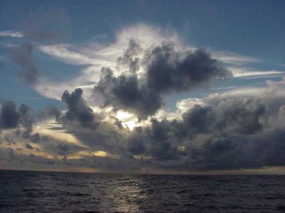
  • weather: almost solid overcast, patches trying to clear
  • wind: N and a little W of N, 20 to 30 knots
  • sea state: developed seas, N swell 8 to 12 feet, wind chop 3 to 4 feet
  • vessel and crew condition: all ok (Faafaite also)

Education Data:

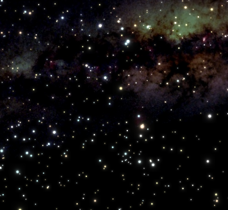
  • Celestial Observations, Navigation Stars, Planets and Moon Phases: overnight only a few stars peeked out of the overcast, nothing consistent
  • Animal Life: None observed overnight.
  • Sea Birds and Sea Life: Gulls, Boobies, etc.
  • Marine Debris: None observed overnight.

Resources

Continue Reading

Hikianalia Report: October 12, 7:38 PM HST, speeding along under overcast skies … dolphins, whale spouts, a field of floating pumice


The strong winds our excellent weather forecasters warned us about have arrived in full force. Last night’s training session was put to good use as the genoa (largest foresail) was replaced by the working jib and then the storm jib, while one reef was taken in the main sail and two in the mizzen sail. These reductions in sail area make the canoe much safer and more manageable in strong winds. Hikianalia is popping, creaking and groaning as her new timbers soak up moisture and swell and her new construction settles into place. Both vessels and crews are fine and we are making good speed on a good course toward our first waypoint, the island of Rapa.

Sail Data

  • time: 2012-10-13 05:38 UTC/GMT (19:38 HST Oct 12)
  • position: 34 degrees 30.9 minutes S 175 degrees 41.7 minutes W
  • course: 090 degrees True
  • speed: 8 to 9 knots
  • weather: solid overcast, light rain
  • wind: just east of north, 20 to 30 knots
  • sea state: NW swells  8-10 feet
  • vessel and crew condition:  all ok (Faafaite also)

Education:

  • Celestial Observations, Navigation Stars, Planets and Moon Phases: too cloudy even to see the sun
  • Animal Life: Naia (common dolphins) frolicking near the manu.  Whale spouts were seen in the distance (possibly sperm whales in the Kermadec Trench?)  This is the same area where Hokule’a saw sperm whales on a previous voyage.
  • Sea Birds and Sea Life: Still quite a few sea birds fishing in this area.
  • Marine Debris: None seen today; but, we had the interesting experience of sailing through a field of pumice stones floating on the sea.  We believe these gray, buoyant stones emerge on the sea floor due to volcanic activity.  They ranged from pea-sized to the size of a man’s head.  Some had barnacles aboard.

Resources

Continue Reading

Hikianalia Report: October 12, 7:13 AM HST, 20-25 knots winds … thrilling to make good speed on such a beautiful canoe.

Weather forecasts had prepared us for strengthening winds and heavier weather. At dinner, Captain Bruce Blankenfeld briefed the crew on what to expect and how to prepare and cope with the challenges of strong winds.

We reviewed the need to clear the decks of all unnecessary gear and tie down securely the remaining items on deck.  We replaced our larger headsail with the working jib, and then later, reefed it even smaller.  We have brought the storm jib up from down below and put it in the on-deck sail locker to be immediately available, if needed.  We reviewed the procedure for reefing (making smaller) the main and mizzen sails.

None of this should alarm the readers back home.  We’re just practicing good seamanship and proper procedures for preparing in advance, rather than being caught with your guard down.  This vessel and crew are well prepared for what we are predicted to encounter.  We are doing very well and enjoying the voyage immensely.  Right now, the sun is shining and breakfast is nearly ready.  It is thrilling to make good speed on such a beautiful, stable voyaging canoe.

Sail Data

  • time: 2012-10-12 17:13 UTC/GMT (07:13 HST Oct 12)
  • position: 34 degrees 56.4 minutes S 177 degrees 46.8 minutes W
  • course: 075 degrees True
  • speed: 9.0 knots
  • weather: clear patches with an interesting mixture of clouds all around – from patchy stratocumulus up to some streaky high cirrus, portending stronger weather
  • wind: began building and filling in about 1 am, now NNE 20-25 knots with more forecast for about noon
  • sea state: SW swell 6-7 feet. N wind swell building 2-3 feet
  • vessel and crew condition: all ok (Faafaite also)

Education:

  • Celestial Observations, Navigation Stars, Planets and Moon Phases: Good navigation stars overnight in the north and the east.  Clouds washed out stars in the south and west.  A beautiful red sunrise this morning made us think of: “Red sky at night, sailor’s delight.  Red sky in morning, sailor, take warning.”
  • Animal Life:  None observed overnight.
  • Sea Birds and Sea Life: Gulls, Boobies, etc.
  • Marine Debris: None observed overnight.

Resources

Continue Reading

Hikianalia Report: Oct. 11, 8:05 PM HST light winds … but gathering clouds foretelling stronger winds

Clear sky all day but gathering clouds in the evening, especially ao nu‘a (thick clouds) and ao manu (high clouds), foretelling stronger winds or a possible system approaching.

(See Predicting Weather: Reading Clouds and Sea Statesand Non-Instrument Weather Forecasting.)

Hikianalia was able to make the best of light winds by experimenting with various sail configurations. We have a full-bellied foresail, called a Drifter, that worked very well as a staysail between the main and mizzen sails.  We were able coax 4 to 5 knots out of very light winds. The gentle pace allowed us good chances for cleaning the canoe and the bright, warm sun encouraged showering. Tonight before dinner, we discussed how we should prepare the canoe, items aboard and ourselves for the predicted stronger winds and worse weather that is predicted along our path.

Sail Data

  • time: 2012-10-12 06:05 UTC/GMT (20:05 HST Oct 11)
  • position: 35.2575 degrees S 179.1234 degrees W
  • course: 065 degrees True
  • speed: most of the day 4 to 5 knots, reduced to about 2 to 3 knots at 5 pm to allow Faafaite to close with us for night sailing
  • weather: clear sky all day but gathering clouds in the evening, especially ao nua and ao manu high clouds, foretelling stronger winds or a possible system approaching. (See Predicting Weather: Reading Clouds and Sea States and Non-Instrument Weather Forecasting.)
  • wind: SW winds have clocked to NW but very light, about 10 knots
  • sea state: predominant SW swell 6-8 feet, NW swell 4 feet
  • vessel and crew condition:  all ok (Faafaite also)

Education:

  • Celestial Observations, Navigation Stars, Planets and Moon Phases: Still too bright for stars.
  • Animal Life: None observed today.
  • Sea Birds and Sea Life: Another albatross flew near us for a while.
  • Marine Debris: One piece of Styrofoam and a bottle were seen.
Continue Reading

Hikianalia Report: Oct 11, 7:35 AM HST “..creeping toward the International Dateline”


Captain and navigator Bruce Blankenfeld had lots of stars overhead to steer by and explain to the crew.  Our terrific sailing winds of yesterday dissipated to very light breezes that have us creeping toward the International Dateline we thought we would reach last night.  Soon we will be in the same date as Hawai’i and Tahiti and we’ll relive October 11th all over again.

This October 11th will be a lot different than yesterday’s speeding along.  It will be a good day for cleaning the canoe, shower baths, etc.  One health concern is always sun exposure, so today will be a good time to exercise proper use of sunscreen, hats, and long sleeves.  We continue to work out the normal kinks in any brand new vessel and all is going well.

Sail Data

  • position: 35.6454 degrees S 179.9428 degrees E
  • course: 075 degrees True
  • speed: 3.0 knots
  • weather: clear all night, some clouds developing overhead
  • wind: light and variable
  • sea state: SW swell 3-5  feet
  • vessel and crew condition: all ok (Faafaite also)

Education:

  • Celestial Observations, Navigation Stars, Planets and Moon Phases: A beautiful clear night with many good stars for navigation and education
  • Animal Life:  None observed overnight.
  • Sea Birds and Sea Life: Gulls, Boobies, etc.
  • Marine Debris: None observed overnight.
Resources
Continue Reading